Property Record
5665 S Westridge Dr, New Berlin, WI 53151


NEARBY LISTINGS FOR SALE OR LEASE
Property Detail
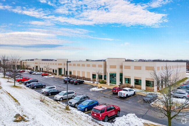
5665 S Westridge Dr
Milwaukee-Waukesha-West Allis, WI
Westridge Business Park
NBC-1285-996-004
PCL 19 CSM #8145 VOL 71/33 REC AS DOC #2167366 BEING REDIV OF PCL 1 OF CSM #8064 PT NE1/4 SEC 34 T6N R20E
Commercialnec
Waukesha
X
Wisconsin
55133C0353H
19
2024
8.97 AC
2024
SE/Muskego
201506
Milwaukee/Madison
100,939 SF
DEMOGRAPHICS near 5665 S Westridge Dr
1 Mile
3 Mile
5 Mile
2024 Total Population
360
34,442
93,739
2029 Population
373
35,163
94,690
Pop Growth 2024-2029
+ 3.61%
+ 2.09%
+ 1.01%
Average Age
44
44
44
2024 Total Households
148
13,849
39,034
HH Growth 2024-2029
+ 3.38%
+ 2.05%
+ 0.96%
Median Household Inc
$105,833
$99,128
$92,336
Avg Household Size
2.40
2.40
2.30
2024 Avg HH Vehicles
2.00
2.00
2.00
Median Home Value
$440,625
$331,585
$320,663
Median Year Built
1993
1980
1979
Nearby Places
Map Layers
Map Styles
 Street
 Aerial
- Restaurants
- Banks
- Shops
- Fitness
- Groceries
PUBLIC TRANSPORTATION
AIRPORT
General Mitchell International
DRIVE
WALK
Distance
General Mitchell International
23 min
13.0 mi
Freight Ports
Port Milwaukee
DRIVE
WALK
Distance
Port Milwaukee
22 min
15.0 mi
SALE & LEASE HISTORY
LISTING DATE
SALE/LEASE

Sep 25, 2016
For Lease
Oct 13, 2025
For Lease
May 10, 2022
For Lease
Apr 18, 2018
For Lease
Nearby Properties
Address
Land Use
TOTAL SIZE
Lot Size
Zoning
Address
Land Use
TOTAL SIZE
Lot Size
Zoning
139,164 SF
25.94 AC
O2
Address
Land Use
TOTAL SIZE
Lot Size
Zoning
464,768 SF
34.90 AC
M1
Address
Land Use
TOTAL SIZE
Lot Size
Zoning
17.68 AC
Address
Land Use
TOTAL SIZE
Lot Size
Zoning
33.26 AC
Address
Land Use
TOTAL SIZE
Lot Size
Zoning
370,169 SF
23.69 AC
RM1
Address
Land Use
TOTAL SIZE
Lot Size
Zoning
Address
Land Use
TOTAL SIZE
Lot Size
Zoning
174,869 SF
17.40 AC
RM1
Address
Land Use
TOTAL SIZE
Lot Size
Zoning
15.24 AC
Address
Land Use
TOTAL SIZE
Lot Size
Zoning
154,897 SF
17.51 AC
O2
Address
Land Use
TOTAL SIZE
Lot Size
Zoning
52,000 SF
12.76 AC
I1
Address
Land Use
TOTAL SIZE
Lot Size
Zoning
74,309 SF
10.28 AC
O2
Address
Land Use
TOTAL SIZE
Lot Size
Zoning
Address
Land Use
TOTAL SIZE
Lot Size
Zoning
217,472 SF
21.27 AC
M1
Address
Land Use
TOTAL SIZE
Lot Size
Zoning
146,270 SF
18 AC
O2
Address
Land Use
TOTAL SIZE
Lot Size
Zoning
139,706 SF
16.50 AC
M1
Address
Land Use
TOTAL SIZE
Lot Size
Zoning
171,506 SF
11.85 AC
M1
Address
Land Use
TOTAL SIZE
Lot Size
Zoning
164,440 SF
11.63 AC
M1
Address
Land Use
TOTAL SIZE
Lot Size
Zoning
172,772 SF
13.53 AC
M1
Address
Land Use
TOTAL SIZE
Lot Size
Zoning
99,648 SF
10.87 AC
B1
Address
Land Use
TOTAL SIZE
Lot Size
Zoning
199,064 SF
7.04 AC
RM1
Address
Land Use
TOTAL SIZE
Lot Size
Zoning
97,217 SF
18.38 AC
M1
Address
Land Use
TOTAL SIZE
Lot Size
Zoning
93,776 SF
7.94 AC
M1
Address
Land Use
TOTAL SIZE
Lot Size
Zoning
Address
Land Use
TOTAL SIZE
Lot Size
Zoning
56,052 SF
8.46 AC
O2
Address
Land Use
TOTAL SIZE
Lot Size
Zoning
122,604 SF
11.12 AC
M1
Address
Land Use
TOTAL SIZE
Lot Size
Zoning
115,848 SF
3.62 AC
B2
Address
Land Use
TOTAL SIZE
Lot Size
Zoning
8.76 AC
B1
Address
Land Use
TOTAL SIZE
Lot Size
Zoning
45,576 SF
9.22 AC
B1
Address
Land Use
TOTAL SIZE
Lot Size
Zoning
15.88 AC
Address
Land Use
TOTAL SIZE
Lot Size
Zoning
200,160 SF
11.44 AC
M1
The World's #1 Commercial Real Estate Marketplace
Connect with us
© 2026 CoStar Group
The information above has been obtained from sources believed reliable. While we do not doubt its accuracy we have not verified it and make no guarantee, warranty or representation about it. It is your responsibility to independently confirm its accuracy and completeness. Any projections, opinions, assumptions, or estimates used are for example only and do not represent the current or future performance of the property. The value of this transaction to you depends on tax and other factors which should be evaluated by your tax, financial, and legal advisors. You and your advisors should conduct a careful, independent investigation of the property to determine to your satisfaction the suitability of the property for your needs.